Official Community Plan
An Official Community Plan (OCP) is a statement of objectives that outlines the long-term vision and policies for land use, growth, and development within a community. It serves as a framework for making decisions on zoning, infrastructure, housing, environmental protection, and other aspects of community planning.
The OCP was recently updated in 2025.
Land Use Designations
The Land Use Map provides residents, Town staff and Council with direction for growth and change. When considering a zoning amendment application, Council uses the Land Use Map to ensure the zone aligns with the Land Use Plan. If a zoning amendment is not consistent with the plan, an OCP amendment can be applied for.
It should be noted that the Land Use Map is not the Zoning Map. The Zoning Bylaw provides the specific details in relation to height, setbacks and densities for parcels in the Town.
View the Land Use Designation Plan
Development Permit Areas (DPAs)
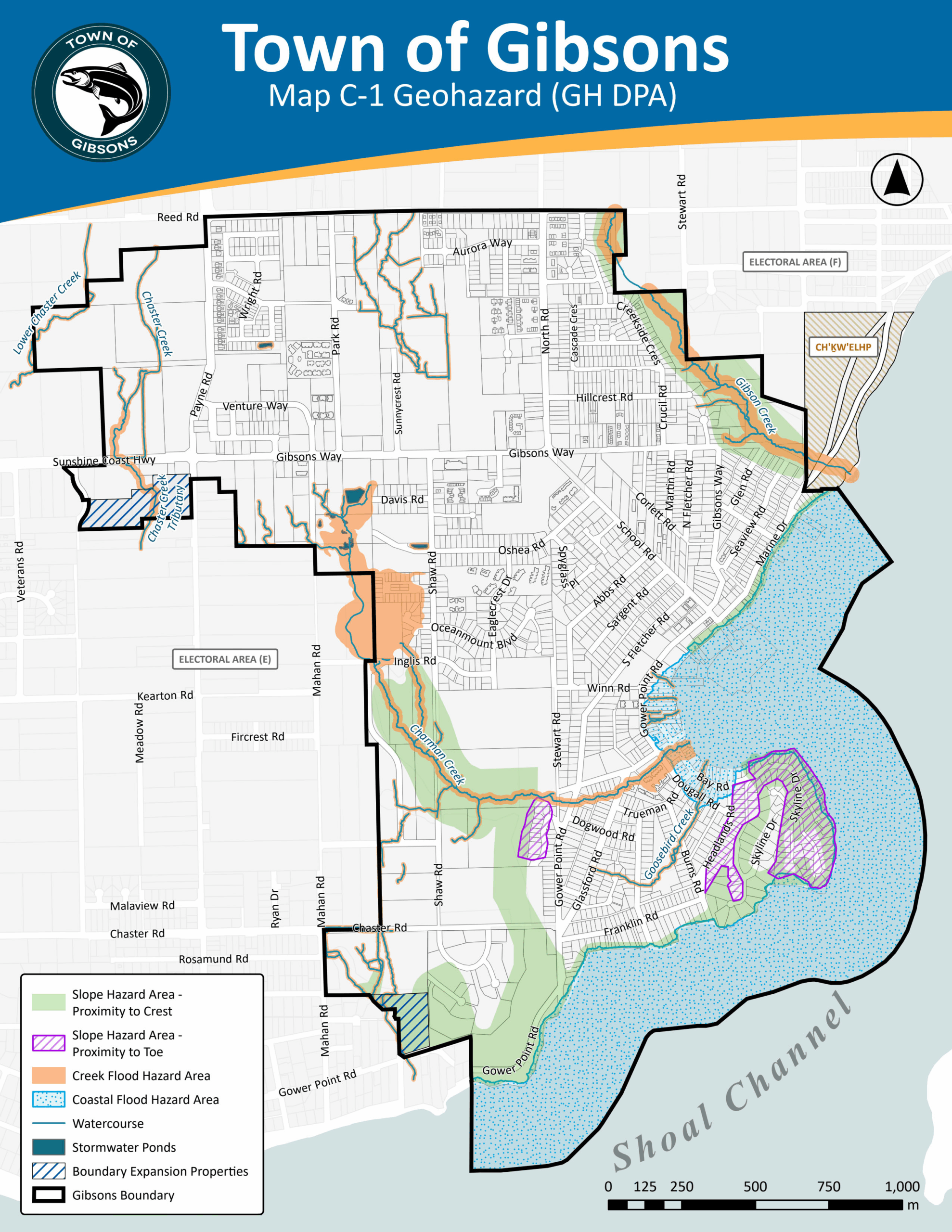
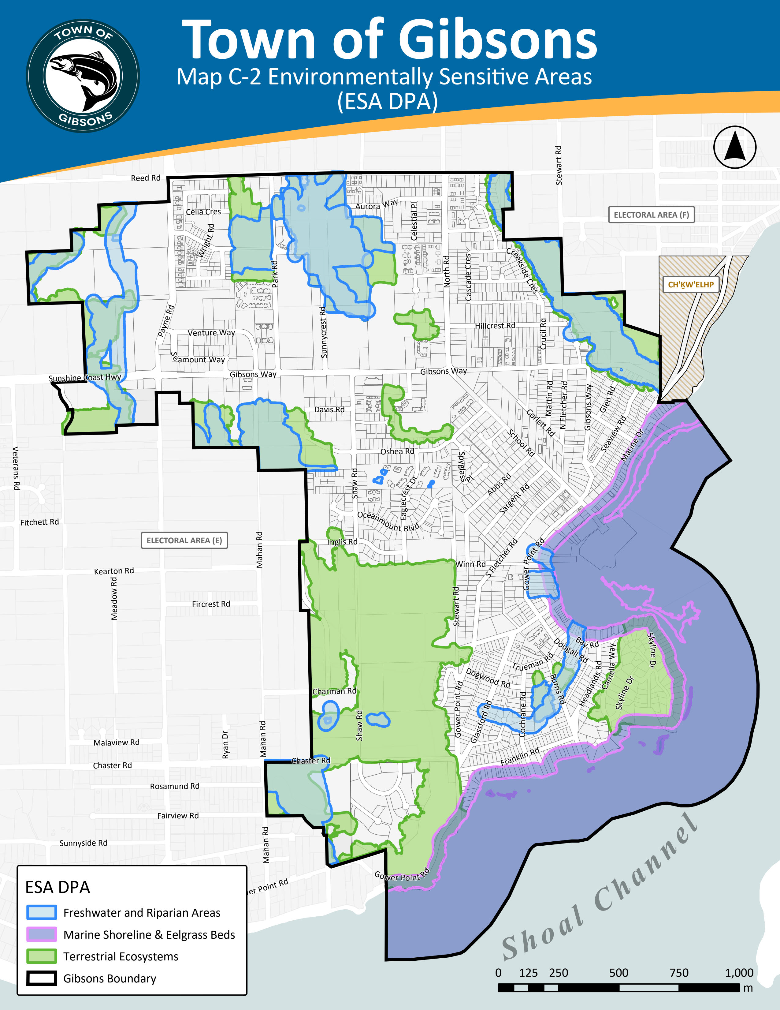


Development Permit Areas
The Town of Gibsons has established three Development Permit Areas (DPAs) to help regulate development in the Town of Gibsons.
2. Environmentally Sensitive Areas (ESA DPA)
3. Aquifer Protection (AP DPA)
Form and Character Development Permit Areas
The four Form and Character Development Permit Areas provide a standard of quality and design for development and public realm improvements in the Town of Gibsons.
1. Upper Gibsons Commercial(UGC) Development Permit Area
2. Multi-Unit Residential (MUR) Development Permit Area
